This satellite constellation transformed earth science by creatively tuning in to GPS signals
Governments and companies have launched similar constellations to use the method, called GNSS-R, to monitor and forecast wildfires, flooding and more.
Governments and companies have launched similar constellations to use the method, called GNSS-R, to monitor and forecast wildfires, flooding and more.

Michigan Engineering is on the vanguard of the next infrastructure revolution
Chris: We had no idea that we had this capability. And it just, it stopped us all in our tracks. I didn’t think it was real.
Narration: Over the past decade, engineers showed us a new way to improve hurricane forecasting, to better predict and monitor wildfires, droughts, floods, locust swarms, and even locating and tracking microplastics in the ocean.
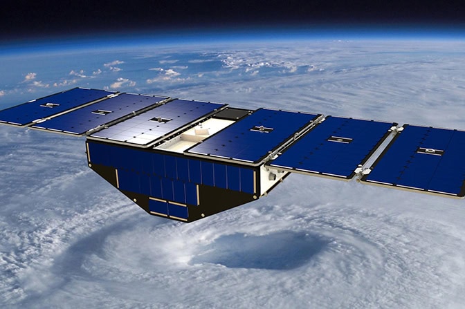
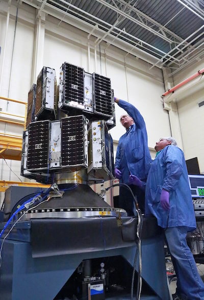
It’s all thanks to a group of small satellites, each the size of a fully grown swan, which have been orbiting Earth single file since their launch in 2016.
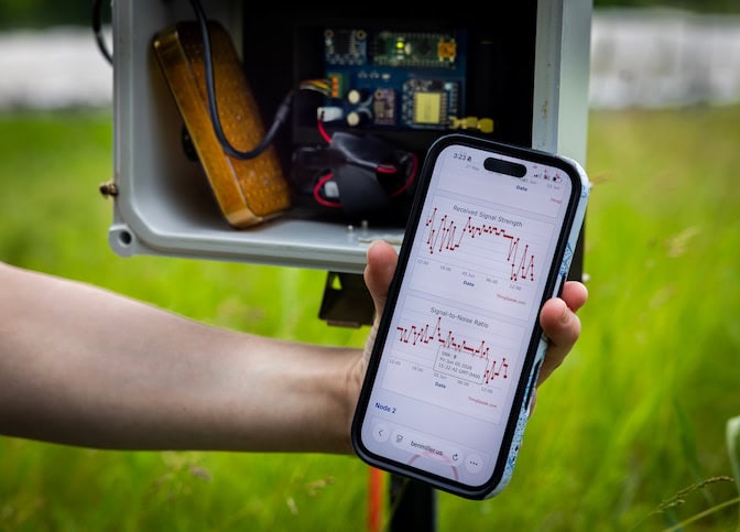
Chris: CYGNSS is exciting because it takes the idea of using GPS as a radar, which had been around for about ten years, and turns it into a practical scientific instrument.
By analyzing the nature of the distortion of the GPS signals, we learn about properties of the Earth’s surface.
Narration: This constellation of satellites, called CYGNSS, uses a method called GNSS-R (Global Navigation Satellite System Reflectometry).
It captures GPS signals bouncing off the ocean to measure how rough the water is, which is helpful for measuring hurricane intensity.
Researchers then discovered that the signals were also useful on land and, by measuring moisture in soil, could better forecast inland natural disasters.
Chris: We had no idea that we had this capability, and it just stopped us all in our tracks. I didn’t think it was real.
There have been a huge number of new missions that have spun up from CYGNSS, and there are now many new satellites flying that either use this technology or have improved upon it.
Narration: This includes Muon Space, which licensed and adapted Michigan’s technology for its FireSat wildfire monitoring program.
Chris: CYGNSS will end sometime soon, but when it does, I think there’s a long legacy of new missions that will continue doing the work.
When NASA’s Cyclone Global Navigation Satellite System (CYGNSS) launched into orbit in 2016, none of the University of Michigan Engineers who developed the system expected it to transform earth science. They certainly had high hopes for the system’s original mission to improve hurricane forecasting, but its ability to pick up reflected GPS signals also proved useful for so much more.
Although the CYGNSS mission is scheduled to end this December, it paved the way for ten similar systems that are now operated by government agencies and companies for monitoring and forecasting droughts, wildfires, floods and even locust swarms. One of the newest constellations—a wildfire-monitoring system called FireSat—was named one of Time’s Best Inventions of 2025. The Silicon Valley company behind FireSat, Muon Space, will launch three additional satellites into orbit this summer.
“I have 40 or 50 grandchildren on orbit right now,” said Chris Ruf, the principal investigator of CYGNSS and the Frederick Bartman Collegiate Professor of Climate and Space Science at U-M. He was elected to the National Academy of Engineering for pioneering the technology.
“CYGNSS is exciting because it takes the idea of using GPS as a radar—which had been around for about ten years—and turns it into a practical instrument that scientists and emergency responders can use in surprising and innovative ways,” said Ruf.
For its impact on science and disaster monitoring, CYGNSS is featured in the Smithsonian National Air and Space Museum’s RTX Living in the Space Age exhibit, which opens today. It all grew from a professor confiding in a colleague about a failed research proposal, and a post-doc who didn’t follow directions.
CYGNSS was the first constellation to produce a high-quality data product by picking up GPS microwaves reflecting off the Earth. It was specifically designed to measure wind speed at the ocean surface. Calm water reflects strong signals in a single direction, but as the wind roughens the sea surface, the microwave reflections become more diffuse and weaker.
Ruf says the method, called Global Navigation Satellite System reflectometry (GNSS-R), is sort of like hacking because CYGNSS satellites opportunistically pick up signals rather than emitting their own.
With GNSS-R, a single satellite can cover more ground because they simultaneously pick up reflected GPS signals from multiple directions—four in the case of CYGNSS.
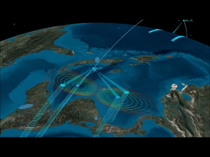
Combining the data from all eight spacecraft allows CYGNSS to cover nearly all of the tropical storm belt in a day. The satellites also orbit in a single-file, evenly spaced line, allowing the constellation to measure the same point on Earth every seven hours, on average. That sampling rate was unprecedented at the time, and it enables CYGNSS to image the eye of the storm between 35% and 49% of a storm’s lifetime. Older systems could only see the eye for about a quarter of a storm’s lifetime.
The GPS signals also pass through intense rain, allowing CYGNSS to measure wind speed in the hurricane’s eyewall, which is like the engine of the storm. While other satellites that operated before CYGNSS could see through rain, their hardware was too expensive for a constellation.
“GPS receivers are dirt cheap compared to radars used to observe Earth,” said Ruf.
CYGNSS’s raging success begins with another project’s failure. Aaron Ridley, a professor of climate and space sciences and engineering, was designing a constellation to study solar eruptions. He was certain that the system of 40 satellites, called Armada, would catch ephemeral disturbances in the sun’s magnetic field to help scientists better predict the sun’s worst outbursts.
But after four months of crunching all the numbers to ensure each piece of Armada would fly where they’d be needed, Ridley got a downer of a phone call. The project leader was scrapping Armada.
Ridley vented his frustrations to Ruf when they stumbled upon each other in a hallway of the Climate and Space Research Building. At the time, Ruf was a GNSS-R skeptic. Scientists had been writing papers on the method’s potential since the ’90s, but Ruf didn’t think it would be useful. As a dejected Ridley explained the potential he saw in Armada, Ruf began to see what was possible with a set of cheap satellites.
“You only make measurements at specific spots on the ground. You can’t just point a camera and make a measurement where you want, which is the way every other sensor works,” said Ruf. “I thought that limited ability to control where you take measurements wouldn’t be practical. And for a single satellite that’s true. But once you can build dozens of satellites, the problem disappears.”
The two collaborated on a new constellation for hurricane forecasting, which Ruf had been working on since grad school. NASA decided to fund the project. And it’s paid off in big ways.
The new view into tropical storms, along with the heightened sampling rate, has improved forecasts of tropical storms. Post-storm studies have shown that the NOAA operational weather model’s predictions of hurricane intensification are closer to reality when using CYGNSS wind-speed measurements. Several other studies have shown that CYGNSS data also improves forecasts of storm track, size and shape, and precipitation.
Eventually, federal agencies acknowledged the potential.
“When we first began to show that this idea works, NOAA administrators asked if we could license the IP to a private company that they could contract with, and that’s exactly what we have done with Muon Space,” said Ruf.
NOAA is now testing how GNSS-R data can further improve their storm forecasting, and China and Taiwan have started operating their own GNSS-R systems for typhoons.
The new users are also working to overcome CYGNSS’s limitations. The original constellation’s receivers aren’t sensitive enough to distinguish among storms rated Category 3 and higher. But Muon Space’s satellites are designed to detect differences between stormier seas.
Because the new receivers can pick up 20 GPS reflections at once, rather than four, they cover even more ground than CYGNSS. In the future, they may beam data to Earth more rapidly by using Starlink satellites as routers, rather than waiting to fly over an antenna on Earth.
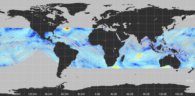
CYGNSS’s data has proven to be valuable for more than just hurricane forecasting. Because the satellites are constantly collecting data as they zip around the planet, they also pick up GPS signals that bounce off the continents.
CYGNSS researchers discovered that the strength of the reflection from land is related to the amount of water in the soil. The wetter the soil, the stronger the reflection. Inland bodies of water reflect even stronger signals. With the data, scientists can create maps of water availability and flooding.

Several companies and governments have also launched GNSS-R systems to take advantage of this capability. Muon Space is researching how the measurements can help predict wildfire risk and spread. The European Space Agency launched their HydroGNSS satellites in 2025 to collect soil moisture data to monitor drought, flooding and permafrost thaw, and the United Nations and Spire Global are testing whether GNSS-R can predict where crop-ravaging locusts might breed, allowing people to cull locusts to mitigate damage.
The terrestrial data stream began with Clara Chew, when she was a postdoctoral researcher at the University of Colorado Boulder. Her instructions were to analyze CYGNSS’s ocean wind speed data, but she couldn’t leave the potential in the land data untapped.
“I love the feeling of looking into data for an application that no one has looked at before,” said Chew. “It feels a little like a treasure hunt. You never know what you are going to find.”
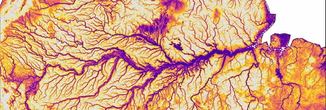
Chew started by collecting CYGNSS data to produce a map of the Amazon. The data revealed all of the major rivers and minor tributaries, as well as how they grew and narrowed in the wet and dry seasons. The view was clearer than you’d get out of an airplane window because the GPS signals passed right through clouds and the rainforest canopy.
“We had no idea that we had this capability, and it stopped us all in our tracks,” said Ruf. “We decided that we had to go to NASA, and they were great about augmenting our budget to expand the scope of our mission. Now, most of the people on the mission work on these land applications. Thank God for postdocs who don’t listen to instructions.”
Today, Chew is head of the GNSS systems and data group at Muon Space, where she is developing GNSS-R systems and soil moisture data products to help fight wildfires. Because GNSS-R makes predictions of fire size and risk more accurate, her team’s data is now being tested in the computer simulations used by California Department of Forestry and Fire Protection (CALFIRE) to calculate where fires will start or spread. The forecasts help firefighters prepare the right amount of firefighting supplies and guides where to start controlled burns to limit wildfire spread.
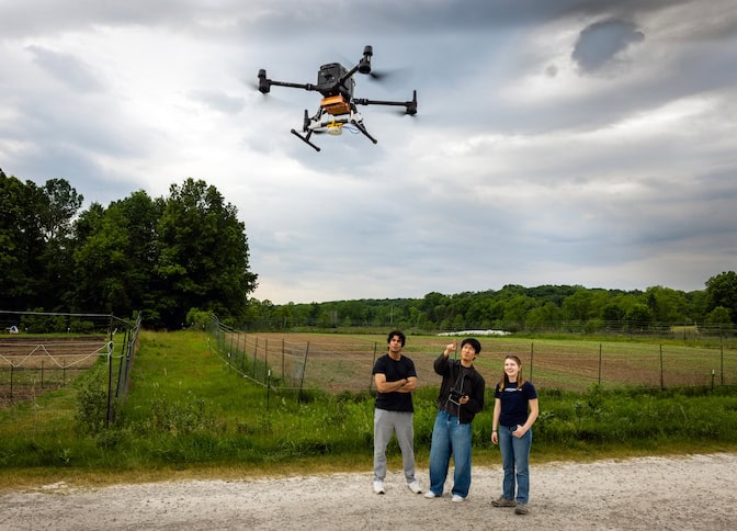
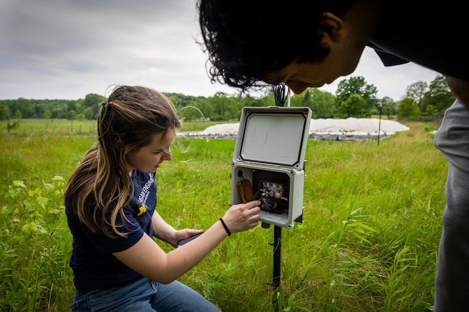
Firefighting is just one of the many ways that the original CYGNSS concept is expanding. Ruf is now moving the technology onto drones, which can make higher resolution measurements and help fill gaps in satellite coverage. Chew is also leading the development of additional data products for flood risk assessment.
The growth of GNSS-R is a testament to how the impacts of academic research can ripple out in big and unexpected ways.
“CYGNSS demonstrated that smaller, cheaper, university-led space missions can do practical, useful things in a reliable way, and that’s a good thing,” said Ruf.
Ruf has a financial interest in Muon Space, which licensed GNSS-R technology from U-M with the help of Innovation Partnerships.
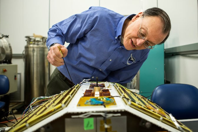
The CYGNSS GNSS-R systems were designed and built by Surrey Satellite Systems Ltd. in the United Kingdom. The University of Michigan’s Space Physics Research Lab has improved upon that design with its next-gen airborne and spaceborne receivers. The lab is also designing and testing next-gen receivers for drones.
The rest of the satellites were built at the Southwest Research Institute.