NASA advances U-M’s Mission Concept Study to photograph entire auroras from space
Two satellites could join NASA’s fleet studying the Sun and its impacts on Earth’s magnetic field.
4 minutes
Two satellites could join NASA’s fleet studying the Sun and its impacts on Earth’s magnetic field.
NASA has chosen a proposal that aims to get the first simultaneous images of auroras at both poles for Phase A of the selection process for the Small Explorers program. Submitted by University of Michigan, Southwest Research Institute, and the University of California, Berkeley, it is one of the four mission concept studies being considered for inclusion in NASA’s heliophysics fleet, and is similar in scale to NASA’s SunRISE mission.
The mission would not only help aurora chasers see their beloved lights, but help protect technology we rely on from harmful space weather.
“The same energy that causes the aurora also damages spacecraft and causes problems on the ground by inducing magnetic fields and currents in power lines and pipelines,” said Michael Liemohn, the concept mission’s principal investigator and a professor of climate and space sciences and engineering at the University of Michigan. “We have a general picture of the Earth’s magnetic environment, but we don’t know the specifics at any one moment.”
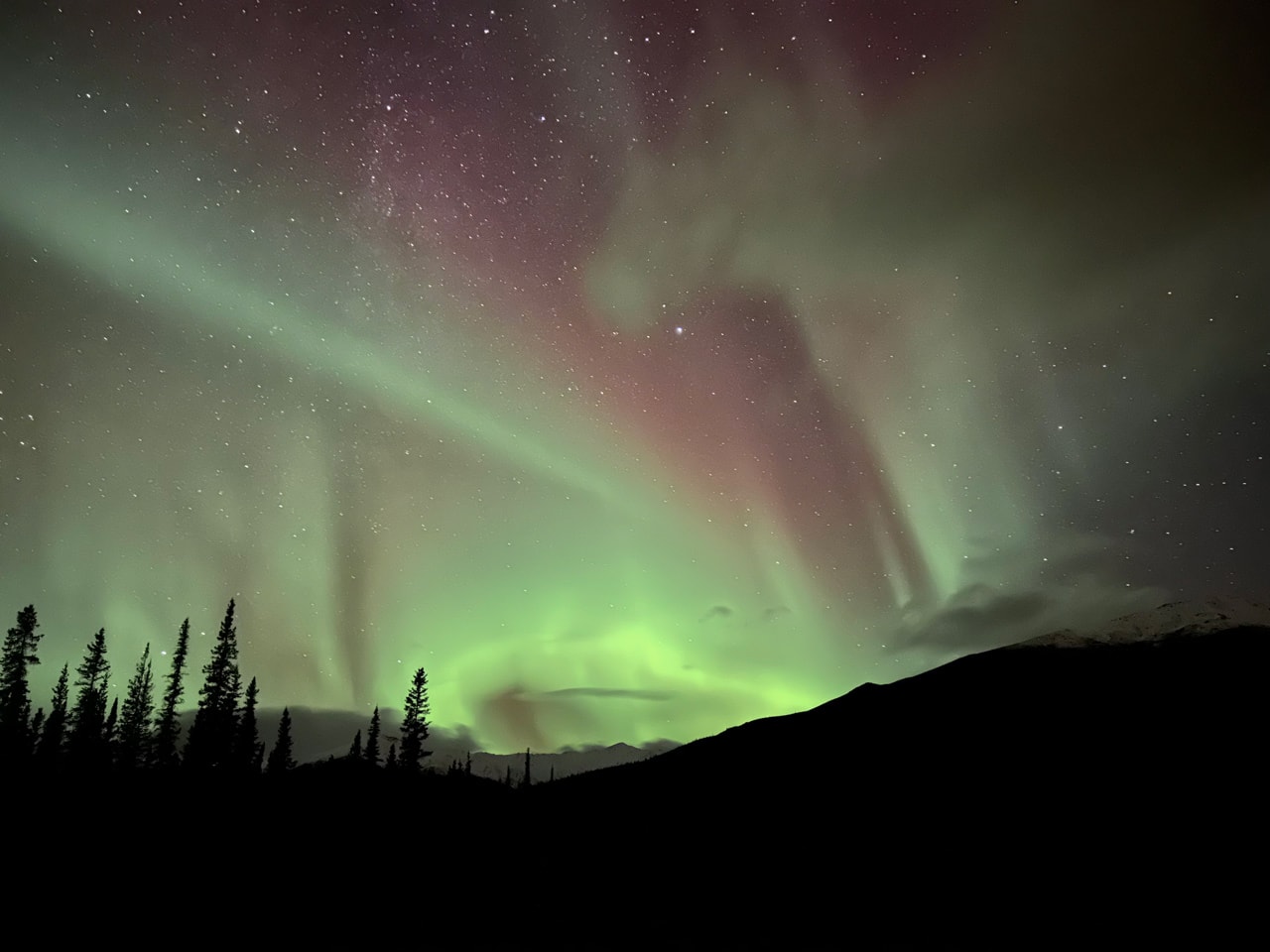
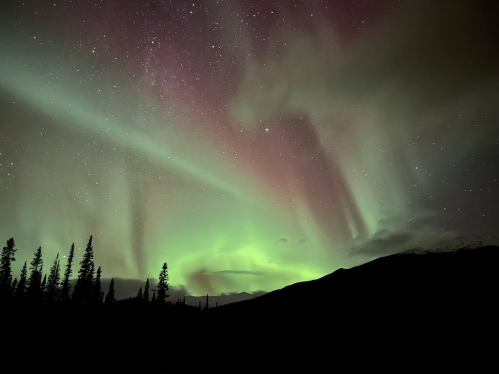
Auroras appear when the solar wind and the sun’s magnetic field load energy into Earth, disturbing its magnetic field and creating wavering ovals of light around the north and south poles. Exactly where and when the aurora will appear over the Earth remains a mystery, in part because no one has ever completely observed each aurora at the same time.

“We really want to completely see the deformities and asymmetries in the aurora because we do not fully understand what shapes them,” said Liemohn. “Eventually, MAAX would lead to better predictions of how auroras will form and how the Sun will squeeze and stretch Earth’s magnetic field.”
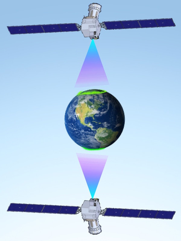
MAAX is the Magnetosphere Auroral Asymmetry eXplorer, a pair of satellites equipped with ultraviolet cameras for creating images that completely cover the auroral ovals at each pole. But the mission is about more than pretty lights—the information on the auroras will feed into forecasts that help engineers prepare for harmful space weather, or large ejections of plasma and energy from the sun.
The consequences of these storms can be dire. Last year, up to 40 satellites fell out of orbit after the sun caused a geomagnetic storm on Earth that heated the atmosphere and increased the atmospheric drag on the satellites. In October 2003, solar storms re-routed airlines and caused large-scale blackouts in Sweden. NOAA’s space weather prediction center produces space weather forecasts in an effort to keep tabs on when massive solar storms might occur, but the sun keeps surprising us—in part because scientists still don’t understand the finer details on how the sun’s energy flows into Earth’s magnetic field.
When Earth’s magnetic field is oppositely directed from the Sun’s, they can collide and open Earth’s magnetic field on the day side. The Sun’s magnetic field can then stretch those open field lines over to Earth’s night side, where they eventually reconnect and create an imbalance in magnetic field strength. Variations in where the Earth’s magnetic field opens and closes and how energy flows between those locations can change where space weather could impact technology on the ground.
“We want to know that whole cycle all at once,” said Liemohn. “By seeing ovals in both hemispheres simultaneously, we could really get to see the distortions and twists in the field that create the aurora, and better understand how much energy harmful space weather loads into Earth and where it goes once it gets here.”
Previous missions have produced images of an entire aurora oval over a single hemisphere as well as two dozen simultaneous images of portions of northern and southern auroral ovals. In contrast, the MAAX mission could provide over a million simultaneous full-oval images in both hemispheres over its expected two-year initial funding duration.
The MAAX satellites would initially operate in a polar orbit at a 90-degree angle from each other, which allows both satellites’ cameras to completely cover a single auroral oval on both the night and day sides of Earth. During a second phase, the satellites would orbit the Earth at opposite ends, allowing them to simultaneously capture images of the aurora at the north and south poles.
If downselected, the Southwest Research Institute would build and operate the satellites, and the University of California, Berkeley, would build the ultraviolet imaging cameras that capture the auroras. The data collected by MAAX will be processed into images and other information at the University of Michigan’s Space Physics Research Laboratory, for use by researchers around the world.