Fire-monitoring satellite aims to transform wildfire detection and response
Remote-sensing technology originally designed for hurricane forecasting at the University of Michigan inspires tools to help fight wildfires from space.
5 minutes
Michigan Engineering News
Remote-sensing technology originally designed for hurricane forecasting at the University of Michigan inspires tools to help fight wildfires from space.
Experts
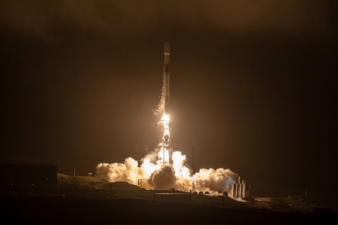
The first prototype of the FireSat constellation launched into low-Earth orbit in March, paving the way for a large network of satellites that will help enhance wildfire detection, mitigation and response around the world.
The entire constellation will eventually consist of 50 satellites that will use infrared cameras to detect and track wildfires from space. They will also use a next-generation Global Navigation Satellite System Reflectometry (GNSS-R) receiver that can measure soil and vegetation moisture based on how the surface reflects GPS microwaves, harnessing signals already bouncing off the Earth from navigation satellites.
Once the FireSat constellation reaches full capacity in 2030, it will provide a near real-time view of the world’s wildfires every 20 minutes, as well as data for more accurate wildfire forecasts and warnings.
FireSat’s GNSS-R receivers are an evolution of the receiver used by NASA’s CYGNSS mission—a satellite constellation developed by researchers at the University of Michigan to improve hurricane forecasting. U-M’s Space Physics Research Laboratory helped design the antenna used on FireSat’s precursor, and Muon Space, the aerospace startup that designed, owns, and operates FireSat, licensed the precursor technology from U-M with the help of Innovation Partnerships.
“It is exciting to see the technology we developed be transitioned from NASA and academia to the private sector and gratifying to see it being used to help address the growing problem with wildfires,” said Chris Ruf, the Frederick Bartman Collegiate Professor of Climate and Space Sciences at U-M, the principal investigator of CYGNSS, and an advisor to the board at Muon Space.
Designed to provide timely data on fire perimeters across every stage of a fire’s lifecycle, the FireSat constellation will lead to better situational awareness for wildfire responders.
“The FireSat constellation would be groundbreaking for us,” said Robert Clark, Assistant Chief of Predictive Services for CAL FIRE, an agency responsible for the state of California’s fire protection and management. “A lot of times, the smoke column obscures where the fire is at, and we have limited aerial resources that could give us information on where it is. In wind-driven situations like the fires we had in L.A., the winds can be so strong the aircraft couldn’t fly.”
FireSat’s infrared cameras will allow responders to track and analyze where the fire is moving. The mission could give timely updates for California residents as well.
“The FireSat initiative aims to provide greater situational awareness than we’ve ever had before, and it benefits not just firefighters, but those living in the community,” said Deputy Chief Marcus Hernandez, who leads the Office of Wildfire Technology Research and Development in California. “Fires get very large so you can’t see the entire perimeter, and they’re in remote places sometimes. We want to see where the fire is moving and the threats.”
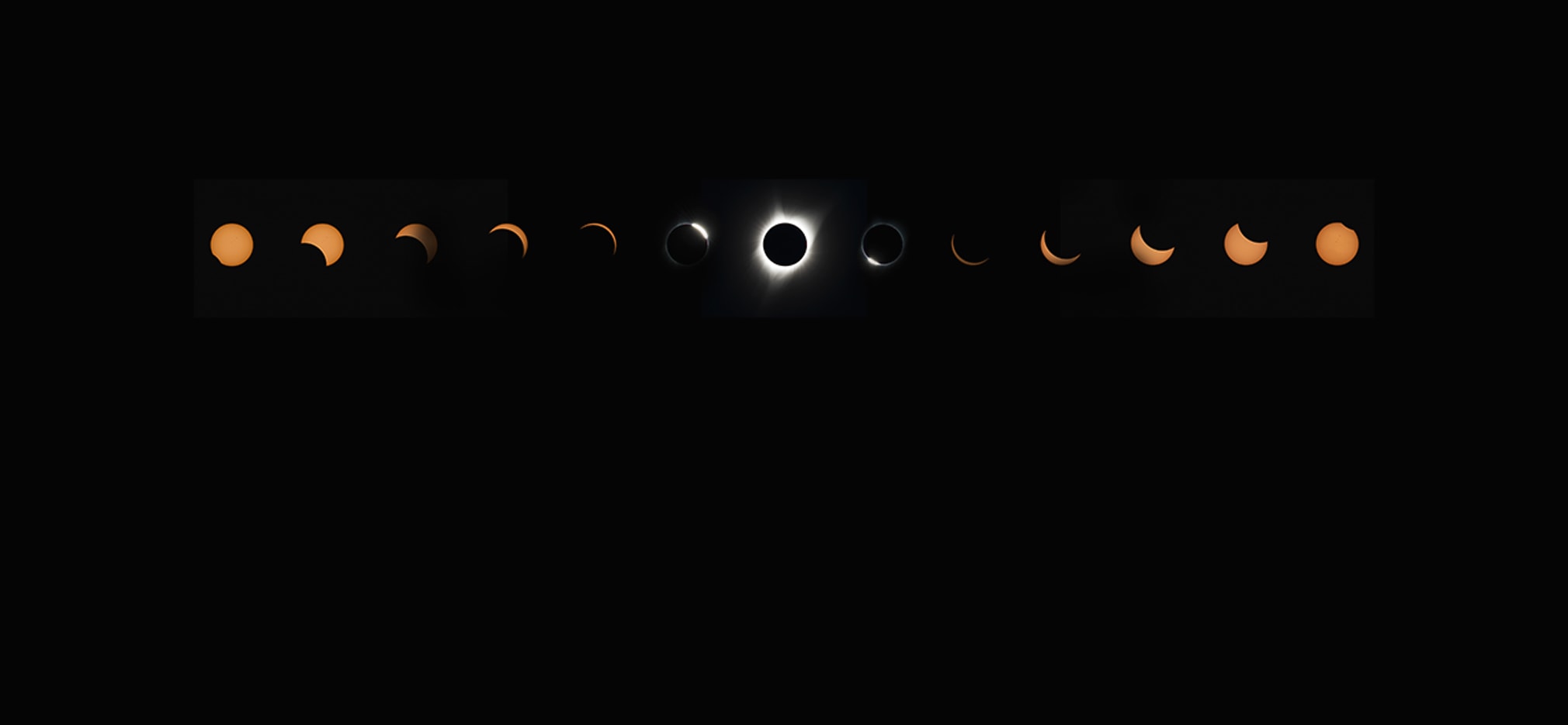
For scientists, students and the rest of us, the April 2024 eclipse helped illuminate some of the sun’s deepest mysteries.
More stories from
The Michigan Engineer magazine
The data from FireSat’s cameras could also help with fire forecasting in the longer term by combining data on wildfire position, movement and severity with weather, climate and landscape data, including the soil moisture data from GNSS-R receivers. When GPS signals reflect off the ground, their strength relates to the amount of water in the soil.
While CYGNSS also used this effect, FireSat will be able to cover more ground. FireSat’s receivers detect microwaves from around 20 different GPS satellites at any given time, five times as many as CYGNSS.
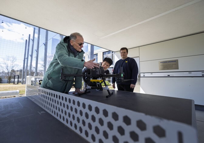
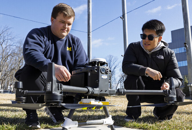
The upgraded receivers also detect something CYGNSS couldn’t: multiple polarizations, or orientations of the GPS microwaves’ electric and magnetic fields. While the first test FireSat can’t detect the new signal, it is planned for a future FireSat in October, 2025.
“There’s potentially a lot of information in that new signal that could help improve all kinds of things about the quality of the science data,” said Ruf. It could help differentiate moisture in soil and plants because the reflected signals from soil have a distinct polarization, Ruf said, but the new method needs to be validated.
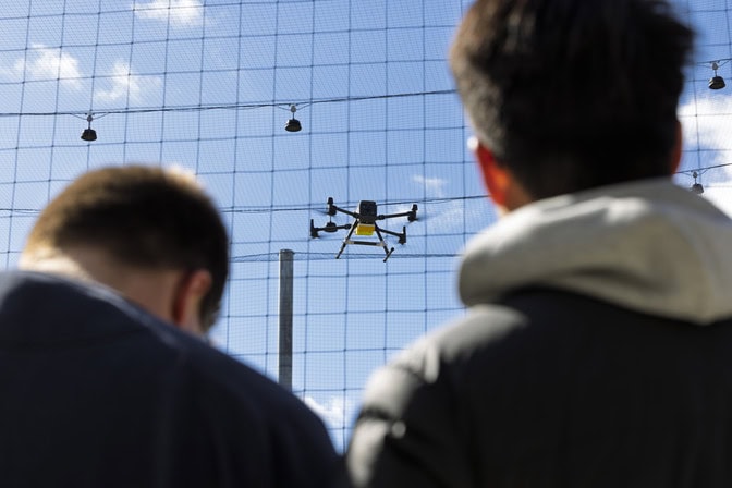
Beginning this spring, the new technology will be flown on a drone to check the data against soil moisture sensors installed at the Matthaei Botanical Gardens.
“The constellation already has promise for many things we’re interested in,” said Hernandez. “We’re very excited for the next year and a half.”
The project is led by the Earth Fire Alliance, a nonprofit that aims to tackle the global wildfire crisis. They are backed by Google, the Environmental Defense Fund, the Gordon and Betty Moore Foundation, the Minderoo Foundation and Muon Space.
Ruf has a financial interest in Muon Space.
Written in collaboration with Melissa Priebe.