Snowfall and drought: $4.8M field study to improve western US forecasts
A mountaintop laboratory and a suite of radar instruments will study winter storms from large-scale cloud movement down to individual snowflakes in an NSF-funded project.
A mountaintop laboratory and a suite of radar instruments will study winter storms from large-scale cloud movement down to individual snowflakes in an NSF-funded project.
Experts
A new science expedition in Yampa Valley, Colorado, will improve forecasts of snowfall and estimates of how climate change will impact snowpack and water availability in the western U.S. mountains, funded with $4.8M from the National Science Foundation.

Michigan Engineering is on the vanguard of the next infrastructure revolution
The field campaign, led by the University of Michigan, brings together scientists from the University of Washington, University of Wisconsin, University of Utah, Colorado State University and Stony Brook University. The team will use an extensive suite of radars and snow-sampling instruments to measure the size and shape of snowflakes and aerosols. The resulting catalog of data will help estimate water availability in the region, where around 67% of the water in large reservoirs comes from melting snow and low winter snowfall can lead to more severe wildfires the following summer.
“We hope that our data will ultimately improve winter storm forecasts and tell western cities when to expect a drought because of insufficient snowpack,” said Claire Pettersen, an assistant professor of climate and space sciences and engineering at the University of Michigan and the lead principal investigator of the project.
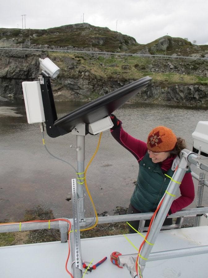
The researchers will deploy more than 30 scientific instruments for studying climate and precipitation for the 2024-2025 winter season in Colorado’s Park Range, a region poorly covered by the National Weather Service’s radar network. The first instruments will arrive at Mt. Werner, a summit near Steamboat Springs, Colorado, this summer. Measurements will begin this December.
Collecting data over an entire winter will provide the statistical power necessary to more accurately predict snowpack after winter storms and over longer periods of time. The data catalog will go not just into an online repository for scientists, but directly to the Yampa Basin Rendezvous, a working group that brings together scientists and local water managers.
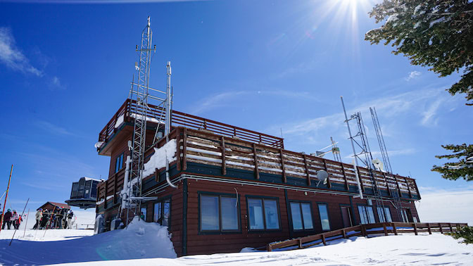
“There is a lot of discussion over how water is used in this basin, as it’s a region that could help feed water to large cities downstream, and water managers need good estimates of snowfall to use that water sustainably,” said Gannet Hallar, professor of atmospheric sciences at the University of Utah and director of Storm Peak Laboratory, a facility atop Mt. Werner that will house many of the instruments.
By combining snow-sampling instruments with radars that indirectly study snow, the researchers will overcome a major challenge of using radar—it’s hard to connect the reflected radar signal with the size, shape and number of snowflakes, which determines the amount of water in the snow.
“We will have the actual characteristics of the snow that we can relate back to what we infer from our radar, which will improve what we can say about snow with radar in mountains moving forward,” said Angela Rowe, professor of atmospheric and ocean sciences at the University of Wisconsin and a principal investigator of the study.
Without such fundamental information, today’s models of snowfall often underperform in mountainous areas.
“In the West, our forecasting models and satellite estimates of precipitation really underpredict snowfall and often don’t get the distribution right,” said Lynn McMurdie, research professor of atmospheric sciences at the University of Washington and a principal investigator of the study.
The team’s radars at Storm Peak Lab will use multiple radar frequencies for detecting snowflakes of many different sizes. At the same time, Brenda Dolan, research scientist at Colorado State University, will deploy the Sea-Going Polarimetric Radar, in Hayden, Colorado. The radar’s view toward Mt. Werner and the surrounding 62 miles will be combined with the National Weather Service’s radars to see how the strength of the storms change as they move toward the Rockies from the west.
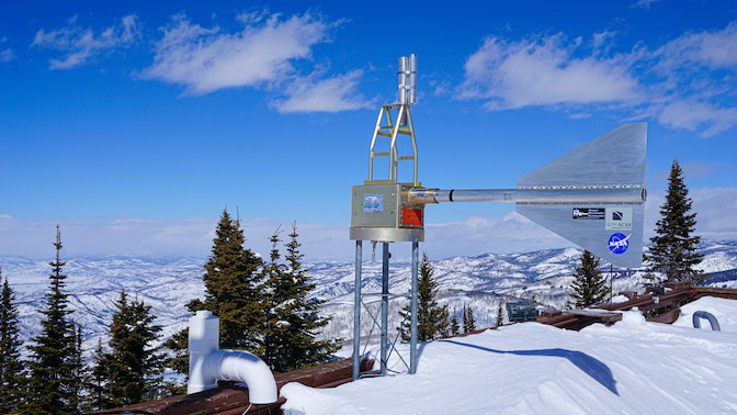
The Sea-Going Polarimetric Radar can’t see how clouds change inside the Yampa Valley beneath Mt. Werner because its view is blocked by the mountains. To cover the gap, Mariko Oue and Pavlos Kollias, both research assistant professors of marine and atmospheric sciences at Stony Brook University, will deploy the Ka-band Scanning Polarimetric Radar. The instrument will detect clouds and snow inside the valley up to Mt. Werner.
Blending multiple scales of data will improve what can be ascertained from radar and link changes in cloud movements to changes in the amount of water in snowflakes.
“Integrating these different scales is a very unique thing to do. The only other way to do it is with an airplane, but that is extraordinarily expensive and only provides one snapshot,” said Jay Mace, professor of atmospheric sciences at the University of Utah and a principal investigator of the study.