Out of the #Flood
In the face of disaster, a city’s social media is saving lives and infrastructure. Is this just the beginning for crowd-sourced salvation?
19 minutes
In the face of disaster, a city’s social media is saving lives and infrastructure. Is this just the beginning for crowd-sourced salvation?
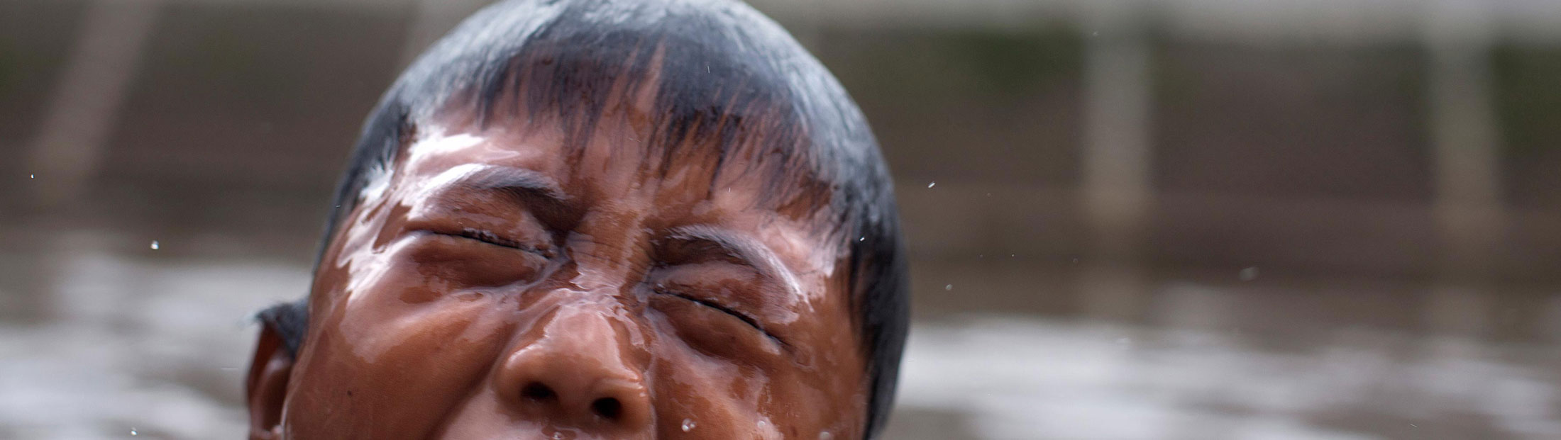
The narrow, cracked pavement that weaves into the densely tangled neighborhood along Jakarta’s Ciliwung River is still slick from the overnight monsoon storms. This vibrant cluster of life is called a kampung in Indonesian; the literal translation is “community” or “village.” But in Jakarta, the word is used to describe a slum neighborhood. On Google Maps, this one appears as just a blank gray swatch. After a twisting series of blind turns, the riverbank comes into view. The overnight deluge has raised the water enough to drown fifteen feet of shoreline. Flotillas of newly immersed trash churn in the intensified current.
For 52-year-old Ibu Atun, the water is literally at her doorstep. She’s lived in this community her whole life. Twice a month the water enters her house. When it’s really bad, her family takes refuge in the nearby school. Atun describes how the frequency of bad floods has increased over the past five years. In 2014, her house was completely submerged. She relies on flood warnings from the neighborhood leader — who receives a phone call from a floodgate operator upstream.
Home to more than 28 million residents, Jakarta and its surrounding metropolis is the second largest settlement on earth. Nearly three quarters of the city is prone to devastating seasonal flooding. Although they’ve been fighting the water for hundreds of years, unprecedented urbanization and climate change have brought the situation to a tipping point. And where traditional solutions are failing, an innovative use of technology is making a difference.
Around the corner, two younger residents are immersed in their smartphones, swiping through their social feeds. They admit to being on them all the time — and can’t imagine life without them. They explain how news of flooding often finds them through their phone.
These two encounters illustrate different ways in which people hear about (and share) news of flooding in Jakarta. Whether it be an announcement reverberating from the mosque loudspeaker, a phone call, the head of the neighborhood, their eyes or with social media — people don’t rely on just one single piece of information about flooding.

Jakarta has one of the highest concentrations of mobile devices and social media activity in the world. By combining these two things with the GPS features inherent to both, the city is tapping into a crowdsourced way of tackling its flooding problem that was not previously possible. They are leveraging something known as geosocial intelligence to make real-time flood maps fed by the social media of residents on the ground – which provides lifesaving information to individuals and emergency responders alike. It doesn’t involve costly, heroic construction projects or installing a vast array of new and expensive sensors along the exhausted canals and floodgates. Instead, open-source software elegantly taps into the on-the-ground knowledge residents have about flooding and turns it into a simple, up-to-date flood report. The emerging resource that geosocial intelligence offers is being realized in one of the most complex urban environments on earth. And what started as one small project is now proving itself as a model that can be used in global cities like Shanghai, Dhaka, Mumbai, Bangkok or even New York.

There is a long history of humans working together to make sense of their environment, especially when it does scary things, like erupt and shake. The way people began to understand and study earthquakes was primitive at first. “We didn’t always know what those were,” explains Etienne Turpin, cofounder of PetaJakarta.org. “We didn’t know why they occurred and we didn’t have any sensitive machinery to tell us where they were occurring. The sensors for earthquakes were human beings’ bodies and their capacity to write down and share their experience of what happened.” Those reports were the beginnings of a system which led to a theory of an earthquake.

Fast forward to today and the emergence of geosocial intelligence, a broad term based on the data that GPS-enabled smartphones can now provide. Like with most innovations, advancements have come in waves. Coincidentally, it was an earthquake that led to an important breakthrough. The 2010 Haitian earthquake death toll was estimated around 200,000.
Etienne Turpin
“During an emergency situation, the number one resource is information,” agree Turpin and Tomas Holderness, PetaJakarta.org co-founders. “There was no formal data about where the hospitals, schools or roads were,” explains Holderness. That’s when volunteers and local residents offered crowdsourced help. Using the open-source mapping platform Open Street Map, individuals mapped small sections. This quickly produced a large map that was used by the Marine Corps as an important mode of intelligence for rescue and recovery. That sparked a major shift.
“It went from, ‘Cool, we can collect geographic information about different places in the world and make it freely available,’ to, ‘We can use that information to actually have a really big change,’” says Holderness. Local knowledge fills the Open Street Map that displays PetaJakarta’s flood data. Ibu Atun’s neighborhood, which appeared as a grey swatch on Google, has street-by-street detail on Open Street Maps.
Although PetaJakarta.org is based at the SMART Infrastructure Facility at the University of Wollongong in Australia, the team’s roster includes a number of key players with Michigan connections.
The most recent wave of innovation has just recently crested. With ubiquitous satellite connectivity, and the mass adoption of GPS-enabled smartphones and social media, user-generated info-maps have become quite common for identifying everything from sanitation issues to crime and disease outbreaks. One of the most popular examples is the Waze app. Its millions of users open the app while driving and contribute to traffic reports, mark speed traps and offer shortcut suggestions. Another example came in the aftermath of the Fukushima nuclear disaster. The Japanese federal government was providing broad-stroke radiation averages that may have been of limited value – a single reading for an entire city, for example. A nonprofit called SAFECAST developed Geiger counters that could be attached to bicycles, cars or backpacks to measure localized radiation levels every five seconds. Users then uploaded that data to a free mobile app, which populated a public map.


What’s happening in Jakarta has an important distinction. The PetaJakarta.org system doesn’t require people to change their behavior or do anything special, like download a new app. There’s no new hardware or reporting portal. During floods, PetaJakarta.org simply tracks the information and photos that residents are already posting on their social networks. It then confirms and broadcasts those conversations onto a simple online map that visualizes flood levels across the city.

“I think this an incredibly important trajectory, especially given the constant complaint about how social media is alienating and a waste of time,” exclaims Turpin. “Well, there may be some truth to that, but our job as researchers is not to critique those systems, it’s to put them to work toward some better end.”

Traditionally, cities tackle flooding problems with civil engineering, by building walls, flood gates and canals, or in extreme cases, redirecting the flow of rivers. Jakarta is no different, but traditional approaches aren’t doing enough — and in some ways makes things worse.
These communities […] know more about water conditions than any engineer in the city.
Frank Sedlar (BSE CEE ’13, MSE ’15)
Before the evening downpour, the mid-morning sun intensifies the tropical humidity. Frank Sedlar is perched on top of an all but abandoned, 100-year-old floodgate. Over his shoulder is a kampung that overhangs the banks of the Ciliwung. “You build flood resiliency through community, not concrete,” says Sedlar, U-M Civil Engineering alumnus and PetaJakarta.org visiting researcher. “We need to engage with these communities because they are the real flooding experts on the river. They know more about water conditions than any engineer in the city.”
However, in many cases, these communities are being evicted to make way for construction. The homes, family businesses and favorite swimming spots will be replaced with cement canal walls. These canals are part of an elaborate system that has massive energy requirements. Yet it’s incredibly fragile. If one floodgate or pump house fails, it’s a domino effect downstream. A single break in the chain can cause flooding to inundate major thoroughfares, causing city life to grind to a halt. Water levels can rise in a flash, threatening riverside communities. These abrupt, compounding effects means real-time information is invaluable to residents and emergency responders.


A 30-minute rickshaw ride north through Jakarta’s never-ending traffic leads to a cornerstone of the city’s flood fighting system, the Waduk Pluit reservoir. It’s where the water from the city’s central canal system is pumped over a precarious seawall into the ocean. Sedlar walks along the wall, which is roughly a foot thick and peaks only a few inches above the waterline. Small leaks trickle out of cracks into the narrow road that lines the dubious barrier. “This is all that is protecting Jakarta from the sea,” says Sedlar. “If this were to break, about 40 percent of Jakarta would be flooded to a depth of one to two meters.”

It’s a frightening scenario for the poor communities that literally live on and around the wall. In the distance, dark sludge is pumped from the reservoir into a barge which will be dumped offshore at the site of the new seawall project. With a price tag of nearly $40 billion, the decades-long endeavor is the biggest civil engineering project on earth. In the end, the seawall will be 40 kilometers long, more than 24 meters tall and will have displaced thousands of people. If completed, it’s difficult to know how long the lifespan of the wall will be. With no official plans released, some estimates suggest it may last only 65 to 100 years.
Simultaneously, inland mega-construction sends increased runoff into the city’s swollen waterways, while contributing to a startling rate of land subsidence — parts of the city are literally sinking between 5 to 20 cm each year.

While PetaJakarta.org doesn’t solve the fact the city will flood during the monsoon, it does address the secondary fundamental problem of information. As the Haitian earthquake so gruesomely illustrated, information is critical in an emergency situation. Jakarta has roughly 680 miles of canals and 13 big rivers that drain to the ocean. According to Sedlar, there are only 26 sensors that measure the water levels. At any given time, about half of them are either broken, stolen or offline. There’s very little real-time information on the water levels, which is critical for making decisions when operating floodgates and pumps — not to mention warning the public.
In the absence of traditional data, the team turned to crowdsourcing. “We told the city’s emergency response department that we just installed 28 million sensors in the metropolitan area,” says Turpin. “They asked, ‘Well how did you do that?’ ‘Well,’ we said, ‘we just let people turn on their phone.’” Holderness and Turpin drafted one of six proposals that won a first-of-its-kind Twitter Data grant — more than 1,300 global applications contended for the opportunity. The grant gave the team special privileges and behind-the-scenes access to Twitter’s geolocated data. If someone tweets with the hashtag #banjir (#flood), the system sees that and sends an automated request for confirmation. During floods, the system has handled 3,000 user requests within an hour, and 240 incoming tweets per second. Other residents see those tweets in real time and like or share them, which then encourages others to report. The way social media rewards users for engaging helps PetaJakarta.org gain popularity, creating a snowball effect.
After a successful trial period, PetaJakarta.org began integrating other social platforms into its system. “It was relatively painless to add new data sources thanks to the modular architecture we used,” says Matthew Berryman the team’s IT architect at the University of Wollongong’s SMART Infrastructure Facility. “And the more data we’ve got on the map, the more useful it is.” And because multiple platforms are feeding the map, if one goes down then another picks up the slack. In a disaster, it’s good not to have all your eggs in one basket.
The sensory contrast between the flood-prone streets and the computerized control center at Jakarta’s Disaster Management Agency at city hall is impressive. Honking motorbikes and vocal vendors are replaced with a quiet concerto of ticking keystrokes and clicking computer mice. Aging infrastructure and oppressive humidity give way to modern offices and air conditioning. BPBD DKI Jakarta is the governmental unit that collects incoming flood data and coordinates prioritized disaster relief. A three-by-seven meter digital dashboard illuminates its mission control room where flood data influences emergency response. Integrated into this dashboard is the PetaJakarta.org map. “Now we’ve got a map that’s connecting the government’s formal information system and the informal information from social media all into one space,” says Holderness. “It’s the connection of all those pieces in one pipe that gives the most valuable information about flooding at that current time. From what we’ve seen, I don’t think that’s ever really happened before.”
During a flood, Bambang Surya Purta, informatics and controlling division head, runs the show. “We need more sensors throughout Jakarta,” says Bambang. “PetaJakarta.org gives us millions of sensors that we don’t have to maintain. It’s a very useful tool for us.” It’s this tool that helps emergency responders spread information to floodgate operators, who then contact neighborhood leaders — like the one who tells 52-year-old Ibu Atun when to take refuge in the school. So although people who have mobile devices can access and contribute to the PetaJakarta.org map directly, it is helping others as well. Whether it reverberates over a mosque loudspeaker, from a phone call, a neighbor or social networks, information from PetaJakarta.org permeates public awareness.

The geosocial intelligence being leveraged in Jakarta is part of a growing trend toward smarter cities. However, at this point, that future typically involves integrating costly, energy-dependent digital sensors into the fabric of our homes and communities, a concept often referred to as the Internet of Things.
“There is no such thing as a smart sensor – a sensor is dumb, it does one thing,” says Turpin. “It reads a temperature, water height or whatever. A human being can look around, smell, hear and use a whole variety of their sensory and mediated relationships to relay information in an emergency.”
Holderness agrees. “A sensor cannot convey the criticality of a flood wall collapsing. It can merely tell you that there has been a change in the electrical signal that it measures.”
Although the team sees potential in the Internet of Things for disaster management, they suggest a different trajectory. They believe that rather than teaching computers to learn what human being are doing, perhaps we should put more effort into using computers to work with people – to learn how to help each other. Instead of addressing challenges with more digital sensors, algorithms and code – some problems require less code, less technical dependence. Instead of building something completely new, why not use what already exists — in innovative ways.
Instead of what Turpin describes as location-based irritation – like what happens when you get a doughnut advertisement on your phone when you walk by a Krispy Kreme — he asks, “What about location based mutual aid? How we can build tools for communities that help them share and allocate resources in ways that we haven’t come close to in our several thousand years of experimenting with democracy?” For the researchers, the real challenge is finding ways to take crowdsourced science from where it is now to a scale where it helps cities become better designers of their own future.
One of the concepts that has become interesting to the researchers in trying to understand geosocial intelligence is stigmergy. Stigmergy is the way in which insects like ants and other swarm-capable creatures mark their environments to coordinate action. Typically, they use pheromones as datapoints that are traceable to their bodies. It allows them to interact dynamically with one another in an environment. For example, when an ant senses some sugar spilled on the counter, it can mark that so others can come collect. When the colony is at risk, signals go out to protect the queen. Now imagine if humans could do something similar. While walking down a city street, if someone witnesses suspicious activity happening in a dark alley, their autonomic bodily response could trigger a warning signal. That signal could be picked up by others on that street to avoid the alley. Perhaps if enough similar signals come from that block, the authorities would be alerted. Or maybe the city would decide to install a street light, or increase patrol.
As we move toward more wearable and even implantable technology, might there be a way for us to capitalize on this kind of insect media? “I think we can,” says Turpin. In his opinion, the real challenge is not the automation of this kind of system. Instead it’s figuring out ways to use it to help solve more common problems — things that aren’t as large-scale as a flood or earthquake, but still require a lot of attention and support.
Smiling, Turpin imagines returning to Jakarta in 10 years and finding their map running autonomously by its users and the government. “That is also the fantasy that I won’t be living in Jakarta in 10 years,” he laughs jokingly about his adopted, flood-prone city. For the team, an even greater aspiration is modestly described by Holderness. “We’ve built on other people’s open-source software and we hope other people will build on ours and use it elsewhere.”
In the meantime, the success of PetaJakarta.org is gaining momentum and may expand to other cities in Indonesia. Alumnus Chris Chiesa, deputy executive director of the Pacific Disaster Center, recently visited with PetaJakarta.org personnel. “We have a proposal in for a PetaSurabaya,” he said, illuminated by the glow of Jakarta city hall’s massive digital dashboard. His visit is part of a growing interest by the broader disaster agencies at the national level to integrate local knowledge, like what PetaJakarta.org provides, into their own systems.
People want to report information because they might need assistance, but also because they want to help their neighbors.
Chris Chiesa (BSE ME ’85, MS ’87)
Chiesa and Sedlar exchange “Go Blue’s” after a discussion about the importance of maintaining a local identity within tools like these. “People want to report information because they might need assistance, but also because they want to help their neighbors,” says Chiesa. “If you dilute that too much on a national level, you might lose some of that significance.” The collaboration is now poised to spread “Petas” across the country. And as extreme weather and sea levels continue to increase, it might not be long before we see a PetaMumbai, or even a PetaNewYork.
As for Ibu Atun and the millions of other families like hers, the next devastating flood is just a matter of time. But when it does come, there will be a faster, more intelligent response.
