When climate change hits home
How an organization led by U-M is helping small-town America plan for a warming world.
PHOTOS & video BY: Marcin Szczepanski
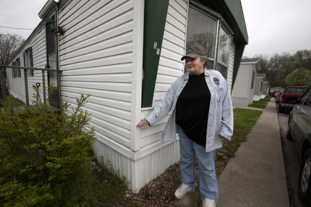
Victoria Gray gazes at the freight train slowly rolling past Creekside Estates in Goshen, Ind., her home for the past 21 years. She taps a white tennis shoe, the tempo quickening as she remembers February 21, 2018, the day the flood came.
“I didn’t know the water was rising…because I don’t go out of my trailer very often,” she said. “I heard a knock on the door and I opened it and it was the fire department in a boat telling me they’re evacuating everybody and I needed to get out now, that there was a place for me at the church down the road.”
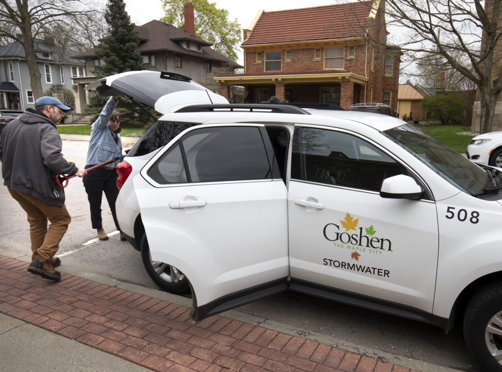
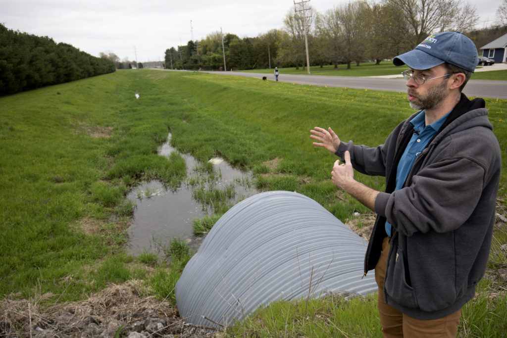
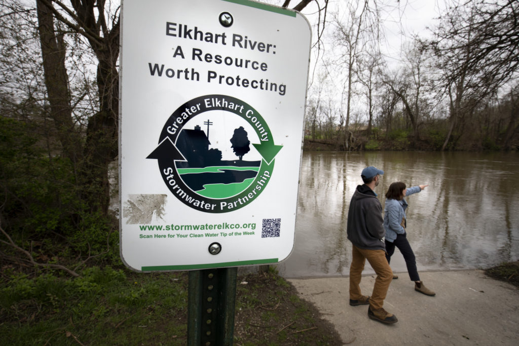
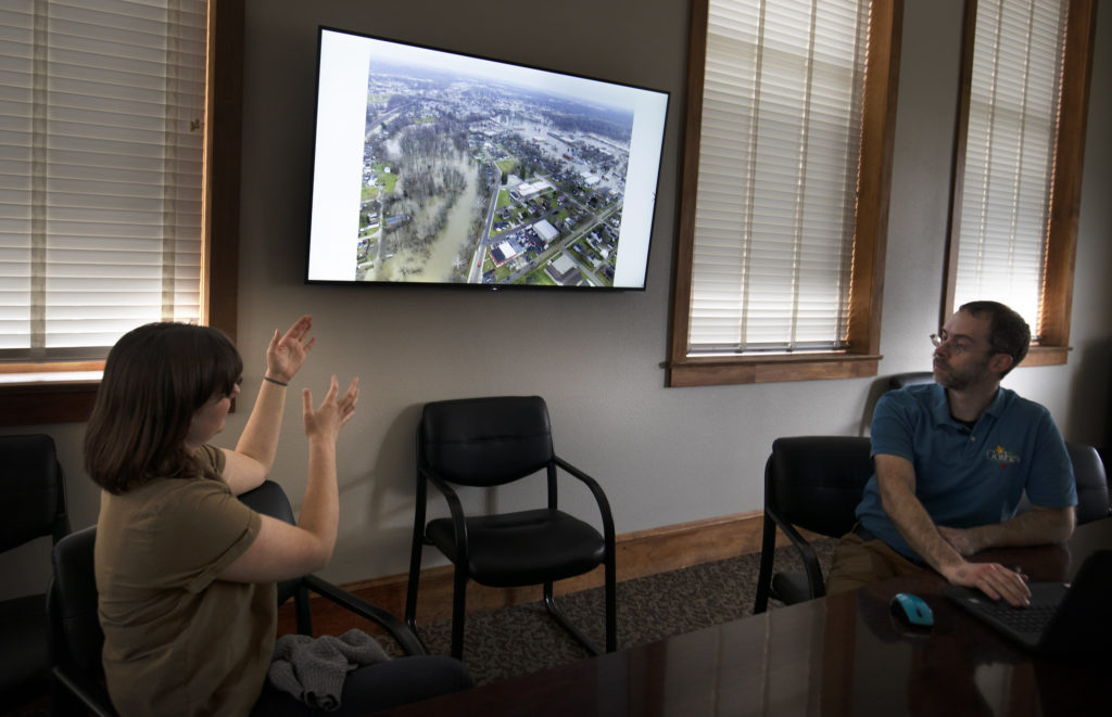
Around the time Gray was boating to safety, Jason Kauffman was coaxing his car through flooded streets and discovering, bridge by bridge, that all his usual routes to work were blocked by the swollen Elkhart River. Kauffman is the stormwater coordinator for the city of Goshen, so his commute was just the beginning of three very long days that saw the Elkhart River crest at 13.2 feet, the highest ever recorded in Goshen.
“As the sun rose, we saw the landscape and realized to what extent it had flooded,” he said. “Seeing the floodwaters covering the roads of the city, and coming up to buildings and homes, it was overwhelming. And what happened in 2018 is going to happen again. It’s not if, it’s when.”
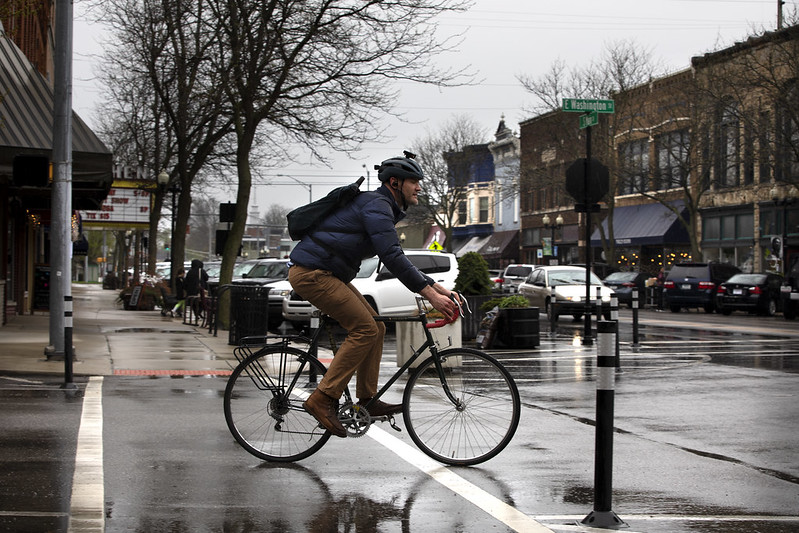
Today, Goshen is back to its close-knit, squeaky-clean self, where a stately brick-and-stained-glass downtown houses centuries-old jewelers and soda fountains, well-paid factory workers churn out more RVs than anyplace else in the world, and everyone seems to know everyone else.
But driving through the streets, Kauffman remembers vividly the way things were four years ago. Trim and wiry, with close-cropped salt-and pepper hair and beard, he’s quick to point out the way it was. His eyes narrow as he remembers.
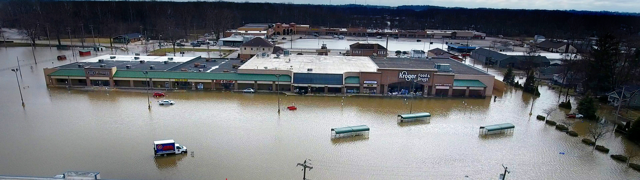
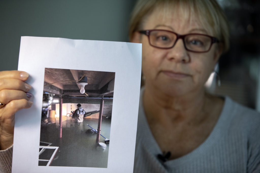
There’s Jeanne and Bill Binkley’s house, where he used to play as a kid— four feet of water in their basement. The Kroger at the end of their street, which feeds much of the city, was completely flooded and closed for weeks. Across the Elkhart River, the 12 acres of Rogers Park simply disappeared underneath the floodwaters. The Oasis, Goshen’s favorite greasy spoon since the 1960s, was damaged beyond repair. Across the street, Sandra Ayala’s Tropicana ice cream parlor went out of commission—flooded along with the nearby Linway Plaza shopping center.
The people in Goshen are linked together by their vivid memories of February 21—the sandbags, boats, trapped neighbors and endless, sloppy shovelfuls of mud. They also remember how they came together—how the fire department patiently convinced Gray that her cats, Jackie and Blackie, would be safe at the shelter; how the mayor helped drag the Oasis’ ruined carpet into the street; how those who were able chipped into a city-wide fund that, among other things, enabled the Binkleys to repair their flood damage without waiting months for federal aid. Maybe most of all, they’re connected by a determination to keep Goshen and each other safe when the next flood comes—especially for neighbors like Gray who live in vulnerable areas.
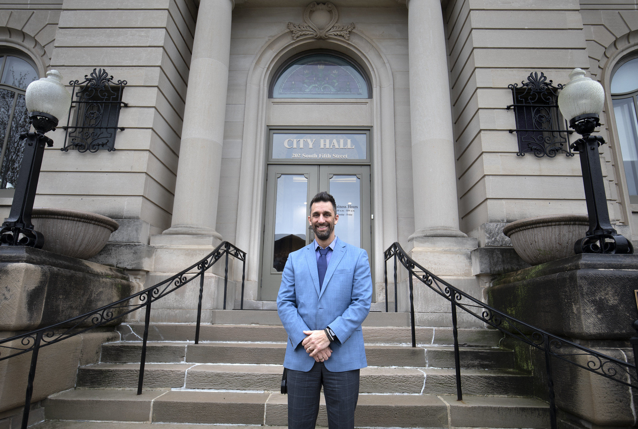
“The flood showed us that we were entering a different time in Goshen, that we needed to learn more about how water moves through our city,” said Goshen Mayor Jeremy Stutsman. “How can we make sure we’re not making stormwater issues worse and where can we fix things and make them better?”
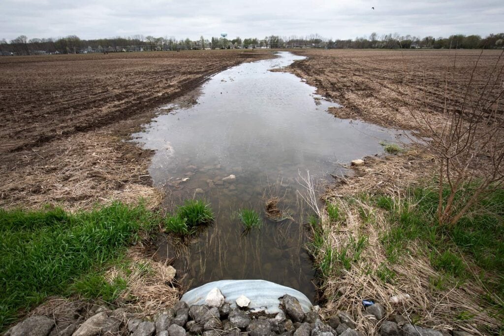
Goshen is one of many Midwestern cities that are beginning to see the impact of climate change on a day-to-day basis. More intense storms are dropping more precipitation in shorter time spans, allowing less time for water to drain away. Warmer temperatures in early spring mean that it’s more likely to rain when the ground is still frozen and unable to soak up moisture. That was a driving factor in the 2018 flood, when heavy rain fell on top of snow cover.
“You can look across the upper Midwest, and you’ll see that what we have called 500-year floods are recurring every few years,” said Richard Rood, professor of climate and space sciences and engineering. “And many of these cities are working with infrastructure that’s a hundred years old. Even if it has been well maintained, it was designed to climate and weather specifications that are actually no longer true.”
It’s likely that extreme weather and floods like the one Goshen saw in 2018 are only going to intensify in the foreseeable future. Even if humans stopped emitting carbon tomorrow, Rood says, we’re likely to be locked into a pattern of intensifying warming and weather changes for at least the next several decades.
“It’s absolutely imperative that we reduce carbon emissions, which will eventually stabilize the warming we’re experiencing,” he said. “But anything we do today won’t have an impact for many years, and in the meantime, we’re in this rapid phase of reliably increasing temperatures. That’s going to have an impact on everything, from ecosystems to cities to agricultural systems, and we need to prepare.”
But many cities, particularly small and mid-sized communities like Goshen, simply don’t have the resources to tackle a global crisis like climate change on their own. So in 2018, Goshen was one of 12 cities that partnered with Great Lakes Integrated Sciences and Assessments (GLISA), an organization led by U-M that’s working to help small and mid-sized cities plan for a future that will be shaped by a changing climate. While GLISA uses the latest climate data, state-of-the-art number crunching and innovative combinations of weather and socioeconomic data, its core strategy is similar to the one that has worked in Goshen for centuries: linking people and resources together through shared trust, shared goals and a sense of community.
Rood helped to create GLISA in 2012. One of 11 regional climate action organizations (or RISAs) across the country funded by National Oceanic and Atmospheric Administration (NOAA), it came into being partly because Rood and his colleagues realized that there was a disconnect between the scientists who develop big-picture climate data and on-the-ground decision makers like Kauffman.
Rood explains that scientists tend to focus on the big picture, building broad datasets that could potentially be useful in a variety of situations. But those datasets look decades or even centuries into the future—a longer time frame than cities generally plan for. And the data are located in places like national NOAA databases that are not user-friendly to local decision makers.
“Nine times out of ten, straight-up climate data isn’t very useful to places like Goshen,” he said. “So we worked to mold GLISA into an organization that focuses on the usability of science.”
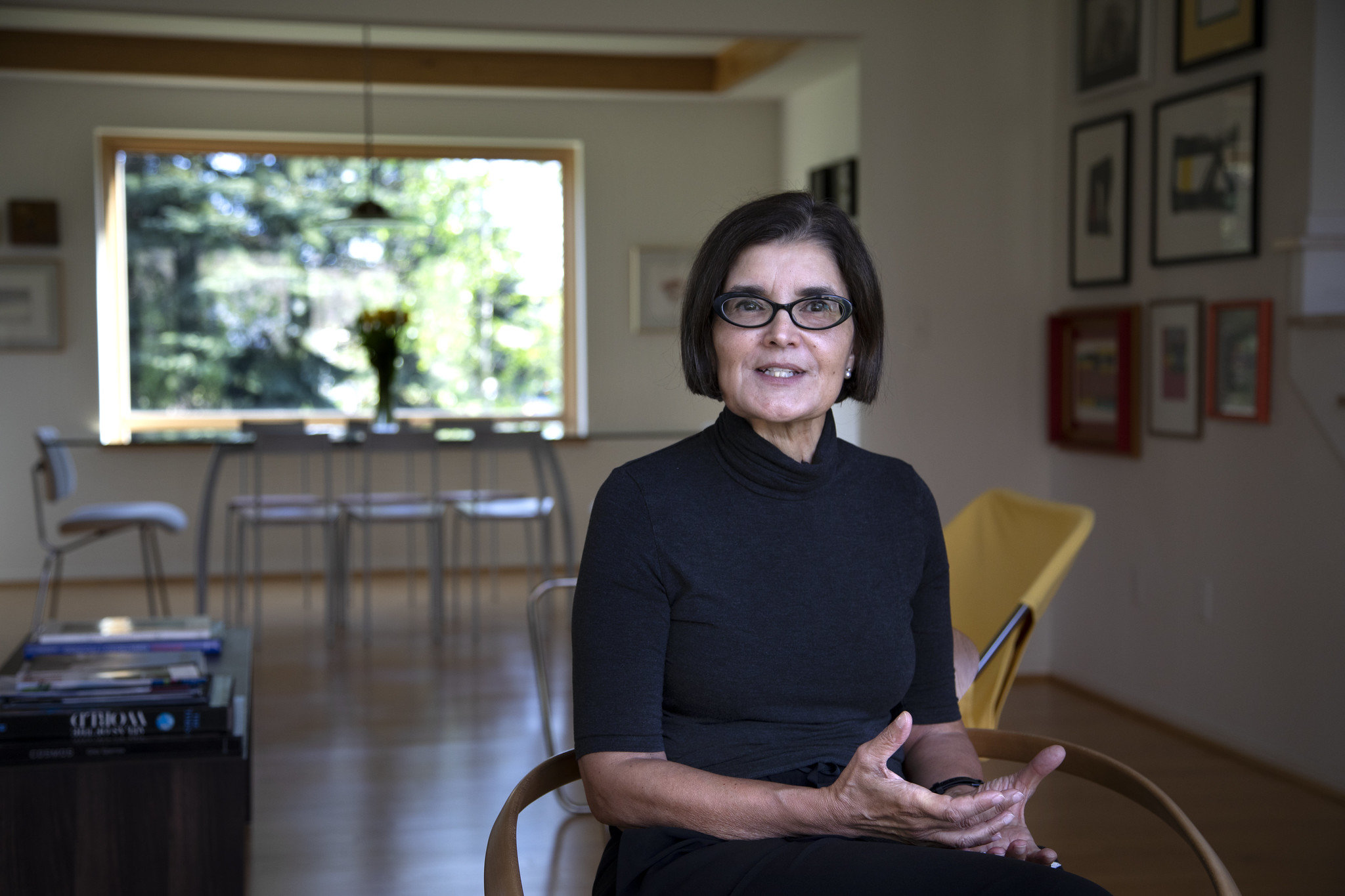
GLISA does this by linking multiple organizations together into what U-M Professor of Sustainability and Development and GLISA Co-Director Maria Carmen Lemos calls a “boundary chain”—a series of partners with different skills and backgrounds that pool their expertise and resources in service of a common goal.
GLISA provides funding to these organizations in the form of small grants—generally $10,000-$50,000. It also coordinates the efforts of the organizations toward their common goal. In a sense, it’s a largerscale version of how the people of Goshen came together after the flood, coordinating and applying individual abilities and knowledge.
“A boundary chain is sort of a shortcut for knowledge creation and trust building,” Lemos said. “GLISA can’t know everyone and can’t build trust with everyone, but by funding several smaller organizations that already have trust and expertise and serving as intermediaries between them, we’ve been able to get a great deal accomplished. And we can get a lot closer to the practitioners and stakeholders who need these resources.”
The vulnerability assessments in Goshen and the 11 other participating cities, for example, began with climate data from GLISA climatologist Kim Channell, which was paired with socioeconomic data from the nonprofit research firm Headwaters Economics.
The next two links in the chain were the Huron River Watershed Council and the Great Lakes Climate Adaptation Network (GLCAN), both of which have extensive experience working with city and regional governments. They worked directly with city planners and sustainability experts to determine how the data could be made relevant to cities like Goshen.
Ultimately, they developed a template that city planners filled out as a group during workshops facilitated by GLISA partners. This enabled them to combine the project’s climate and socioeconomic data with their own historical knowledge and expertise. City staff completed the assessment on their own, and GLISA then formatted the assessment into a final professional-looking report to be used to inform future plans, policies and projects.
“These tools are designed to get citizens, politicians and engineers together to talk about how a flood might affect neighborhood A versus neighborhood B, about why we might prioritize fixing these culverts as opposed to restoring that wetland or these bioswales,” said Patty Hernandez, co-founder and executive director of Headwaters Economics. “Discussing together why they might prioritize different projects.”
The Boundary Chains technique, the subject of a 2014 paper on which Rood and Lemos were co-authors, has been at work at GLISA for a decade. Among other projects, it produced a Consumer Reports-style rating system to help city and regional governments in the Great Lakes region find accurate climate data, helped Isle Royale National Park develop a strategy for managing its wolf population in the face of climate change, and provided resources to Great Lakes fruit tree farmers to better understand how climate change will affect their trees’ vulnerability to climate events. GLISA completed the program in which Goshen participated in 2018, connecting climate data and resources with local practitioners in 12 small and mid-size cities across the Great Lakes region.
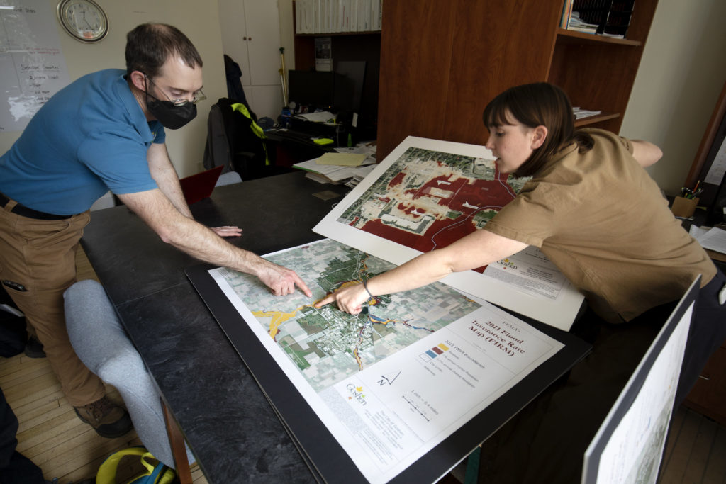
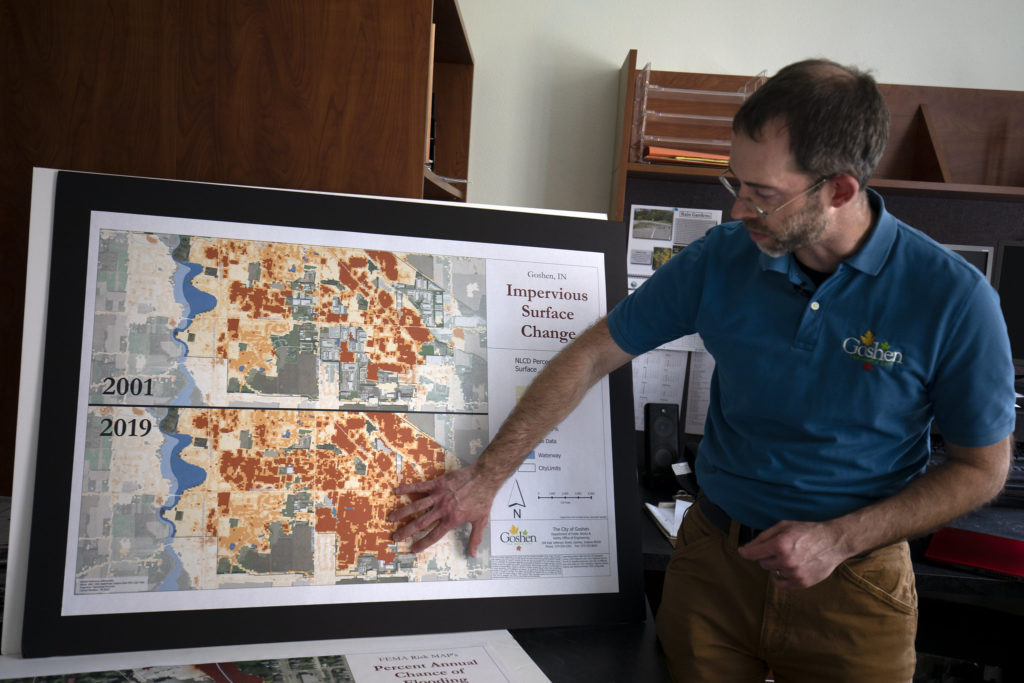
One of those practitioners, Mattie Lehman, sits behind a table piled with enormous, full-color paper maps in the Goshen Annex, a former high school rehabbed as office space. The well-polished wooden lockers outside their office attest to the building’s former use, as do the maple floors that bear the wear of more than a century of students shuffling to class.
Lehman and Kauffman comprise Goshen’s two-person stormwater management staff, and like most people here, they both have deep roots in Goshen. Lehman grew up here before traveling to Virginia for her undergraduate studies and continuing to Missoula, Montana, to complete a master’s in environmental studies at the University of Montana. She also spent time in Washington, D.C., and Indianapolis, Ind., but eventually began to feel that her hometown needed her.
“I remember sitting with a group of friends in D.C. and thinking about how rarely people bring their good ideas home,” she said. “I think in Goshen, there’s a recognition that things are changing, and that brings an opportunity to say, ‘OK, what can we do about it, how can we make a difference?’ And particularly when you talk about adaptation planning, there’s a lot of low-hanging fruit, a lot of ways to have an impact. That’s why I came back. And yeah, my friends and family are here and I care what happens here. That’s a big one.”
But for Lehman and Kauffman, it’s often difficult to find the time to focus on big-picture issues. They’re as likely to be inspecting a construction site or squishing through a drainage ditch as they are to be in the office. They both spend some time each year paddling through the Elkhart River looking for flows of suspicious-looking liquids, and when RV plants were found to have blocked a drainage canal with dozens of giant Styrofoam packing blocks, it was Lehman who sorted out the cleanup. The GLISA assessment project provided a rare opportunity for Kauffman, Lehman and other city planners to focus on the future rather than on putting out day-to-day fires.
“I was super excited to engage in this project because of its impact here in Goshen,” Lehman said. “Climate change and mitigation and adaptation were all terminologies that I was familiar with but I hadn’t seen that in practice in the same way that I was able to when I plugged in here.”
Lehman’s penchant for the big picture may be why she became an expert in GIS software, a digital mapping tool used by cities to map property lines, draw up plans, track utility infrastructure and a variety of other purposes. One of her first tasks at Goshen was to apply that expertise to the GLISA project. She helped integrate the project’s socioeconomic and climate data into nearly a dozen detailed maps that show Goshen’s elevation, land slope, floodplain areas, soil drainage, the precise location and extent of 2018 flood damage and several other variables. Her brown eyes and freckled smile drift down toward the table as she leafs through the big printouts.
“This project was a chance to learn really quickly what’s going on in my hometown when we’re talking about on-the-ground climate impacts that are happening now,” she said.
Lehman’s return coincides with heady times in Goshen; long known as the RV capital of the world, it’s experiencing the kind of boom that many Midwestern cities haven’t seen since the early 20th century. Demand for RVs has rocketed back after collapsing in the 2008 recession, and it has driven an influx of people from all over the country, even from as far afield as Central America, to fill the good-paying jobs in the city’s many RV factories.
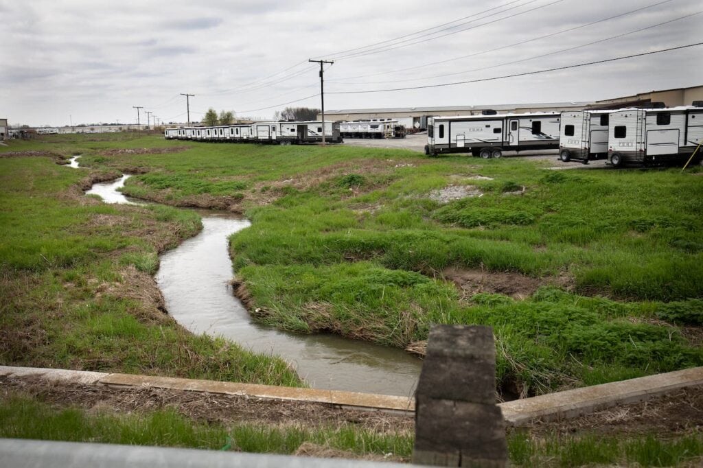
The RVs those factories churn out are stored in vast fields on the southeast edge of town, where row after row after row of gleaming travel trailers sit, precisely packed together and waiting for pickup. And many of the workers inside the factories are buying new houses in the subdivisions that are springing up on the edge of town.
All that development keeps the two stormwater managers busy finding ways to develop land responsibly, without worsening the city’s flooding problems. Those new houses, for example, are going up in former farm fields that once served as natural paths for stormwater to drain into the river. Now that water has to go somewhere else, and the homes must be protected from flooding. And the RV storage lots sit perilously close to the river, potentially within reach of floodwaters. Protecting such sites is just one of the many jobs that fill Kauffman and Lehman’s days.
“We do public education and outreach, public involvement, illicit discharge detection and elimination. And then construction site runoff control, erosion sediment control during construction projects,” said Kauffman. “And then post-construction on those properties that have gone through that process. And then good housekeeping and pollution prevention, managing our own facilities….”
The GLISA assessment’s maps and other resources have already proved themselves to be a key planning tool in those day-to-day jobs. In addition to helping to inform the design of new stormwater management systems, they can help residents and business owners better understand how their individual project is connected to the city’s flood vulnerability.
“When we’re having conversations with other city employees or with developers, it’s so helpful to have data we can point to that says, ‘This is why we have these rules for stormwater retention, this is why a certain site maybe needs to be developed a little differently,’” Lehman said. “When people can understand why we’re doing what we’re doing, it makes it a lot easier to get through those difficult conversations and come out with good decisions.”
Data from the assessment also enabled planners to assess just how vulnerable different areas of the city are to flooding. Some areas can benefit from flood-proofing measures like retrofits to buildings or increases in permeable area. Others, like Victoria Gray’s mobile home park, are so vulnerable to flooding that it’s simply not feasible to flood-proof them. Armed with that knowledge, city planners can prioritize rescue resources to those areas in the event of a flood and make sure they’re first in line if federal buyout funds become available in the future.
Even though Lehman grew up here, she says getting an overview of the city’s growth patterns, demographics and vulnerable populations has given her and other city officials a new perspective. And that perspective could help keep residents like Victoria Gray safe when the next flood comes.
“Overlaying socioeconomic data helps us see areas that might need more assistance in a flood—maybe it’s an area of mobile homes, or an area where more people speak English as a second language,” she said. “What are the practical impacts of those things when we’re thinking about communication and logistics during a flood? Those are questions we can now ask in a much better way.”
The assessment also helped Goshen develop its first flood resiliency plan, which includes recommendations for more stormwater management funding, updated emergency plans, new development and zoning strategies and the integration of flood resiliency considerations into the city’s master plan. The climate resiliency plan was adopted by Goshen’s City Council in July of 2022.

But Goshen is more than just a beneficiary in GLISA’s efforts. Catherine Kemp, a graduate student in the U-M SEAS program and a research assistant at GLISA, worked with Lehman and other Goshen officials in 2021, and she’s now working on the FloodWise Communities. She says one of the key strengths of the boundary chain model is that it enables each link to both gain resources from the current project and contribute knowledge to future projects.
Input from Lehman and others on the importance of GIS map integration is helping to inform FloodWise Community. Already underway along the Gulf coast of Alabama, Florida, Louisiana, Mississippi and Texas, GLISA and partners are working with over 50 small and mid-size communities in the region. They have access to an improved suite of resiliency planning tools developed by Headwaters Economics, including maps from their Neighborhoods at Risk socioeconomic data mapping tool that integrate with the GIS software used by most cities.
“The vulnerability assessment reports that we developed with Goshen and the other Great Lakes cities were better than what they had before, but we got a lot of insights about how they could still be improved,” Kemp said. “City staff told us things like, ‘Our council member is really interested in the climate information but doesn’t have time to read the whole report. We have projects where we need precipitation projections or temperature projections, so it would be great to have stand-alone products with quick facts.’”
Hernandez says the goal of the tools is not just to pack in as much data as possible, but to present it in a way that will start conversations across different areas of city government. And because the reports combine flood vulnerability with socioeconomic data, they can start conversations not just about flooding, but also about how to prioritize resources to produce the greatest impact.
The FloodWise Community project kicked off in early 2021 and has already completed the assessment process with most participating cities. GLISA is on track to wrap up the project in early 2023, culminating with a series of findings that will help them further improve their next project. Similar projects are underway in the other 11 RISA organizations around the country, using global data and local expertise to tackle climate change challenges one at a time.
Rood emphasizes that the goal is not to “fix” climate change, which will continue for decades if not centuries, but to help the Victoria Grays, the Sandra Ayalas, the Jason Kauffmans and Mattie Lehmans around the country work step-by-step toward their best future.
“We need to start thinking about what our planet will look like in the future, rather than trying to anchor it in the past,” Rood said. “There will be loss and we need to prepare for that loss. There will also be opportunity and gain.”
Sandra Ayala is one Goshener who has taken that message to heart. After the months of cleanup that followed the 2018 flood, she reopened her Tropicana ice cream shop in a larger location. Her new shop is a riot of pink and turquoise, with giant ice cream sculptures and a huge variety of ice cream and toppings. Ayala makes her own ice cream in flavors inspired by her native Mexico, like guava, avocado and mango with chamoy—a spicy-sweet syrup infused with chile pepper.
Goshen Mayor Jeremy Stutsman
Maria Carmen Lemos is GLISA’s co-director a Professor of Natural Resources and Environment at the University of Michigan. Photo: Marcin Szczepanski/Michigan Engineering
Sandra Ayala shows off her popular Mexican style ice cream in a new location in Linway Plaza. cIn 2018 Sandra Ayala’s Tropicana ice cream parlor went out of commission–flooded along with the nearby Linway Plaza shopping center. Photo: Marcin Szczepanski/Michigan Engineering

Ayala’s husband gave up his job in an RV plant to help run the shop, and they say their business has doubled since moving into its current location. The Tropicana has been a draw for the Mexican immigrant community for years, and these days it’s also becoming popular with the Amish who come in from surrounding areas, parking their horse-drawn buggies out front.
Ayala knows that Linway Plaza will probably flood again. Still, she’s not going anywhere. This is home, and she sees more value in strengthening connections than breaking them.
In a sense, Goshen and places like it are the original boundary chains. And Rood, Lemos and the rest of GLISA hope that early-adopter communities like Goshen can serve as examples of how it’s possible to link resources, knowledge and trust on a scale that can help them get through difficult conversations and apply pragmatic solutions as the consequences of climate change take shape in cities around the country.
“Let’s lay out the time span, make the problem small enough, local enough, regional enough, so that we can see things that we can do, within the budgets that we have,” Rood said. “There’s this issue. We know what is coming. We have the power to influence it. But can we collectively get together in a way to do that? I think the answer is yes.”