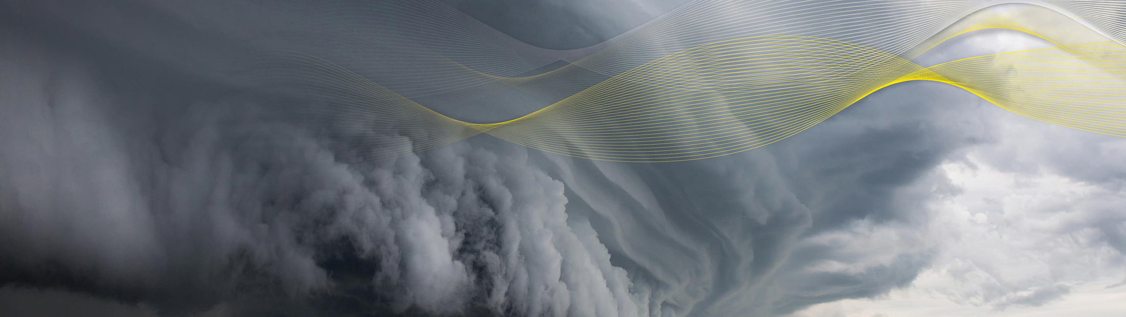
Into the Storm
The most turbulent region of a hurricane holds secrets about its potential for destruction. Michigan Engineering’s newly launched satellite system can reveal how these storms intensify in a warming world.
Michigan Engineering News
The most turbulent region of a hurricane holds secrets about its potential for destruction. Michigan Engineering’s newly launched satellite system can reveal how these storms intensify in a warming world.
The four-engine turboprop was holding steady at 1,500 feet above the roiling Atlantic. Flight director Jeff Masters looked out his window. He could see waves cresting a quarter mile beneath the fuselage. He turned back to his computer, adjusted the radar display, and looked into the eye of Hurricane Hugo.
The storm would soon break a record as the strongest to make U.S. landfall north of Florida. Masters (BSE, MS, Ph.D., AOSS, ’82, ’83, ’97) was leading a 15-member crew straight into it.
On his screen, he zoomed in on the eye. He fixated on the ring of red and orange pixels around it – the eyewall.
The core of a tropical storm holds one of the most abrupt weather changes on Earth: Spiraling around the calm center, the eyewall is a tall cloud column of dizzying winds and hard rain. It’s where a hurricane is most intense – home to the maximum sustained winds that sort it into one of the familiar five categories.
“With each sweep of the radar, it grew more ominous,” Masters wrote on his blog.
The year was 1989. At the time, and up until very recently, the only way to gauge the brute strength of a hurricane was to tear through its roughest realm in an airplane packed with weather instruments. (No parachutes; they wouldn’t do any good.)
Until December 2016, even the most modern weather satellites couldn’t see through the heavy rain of the eyewall to measure the all-important wind speeds at the surface. So for the past six decades, the National Atmospheric and Oceanic Administration’s (NOAA) band of Hurricane Hunter aircrews have flown through storms threatening the coastal U.S. The missions give scientists and weather forecasters invaluable snapshots of a storm’s potential for destruction.
But hurricanes still harbor secrets. Scientists need more than snapshots if they’re to understand the details of how they form and evolve.
And why some grow suddenly stronger, as Matthew did in 2016. In just 24 hours, it swelled from a Category 1 to a Category 5. Matthew killed more than 1,600 people, most of them in Haiti. Scientists say such rapid intensification might happen more often in a warming world.
A better understanding of the process could lead to better predictions of not just winds, but also storm surge – the swells of water hurricanes bring when they make landfall. It’s the flooding that makes them so destructive.
A new constellation of satellites could provide the key to these predictions.

Michigan Engineering Professor Chris Ruf sat on a brightly-lit stage at Kennedy Space Center dressed in a suit and tie. The room was packed with journalists. The press conference was being broadcast live on NASA TV. It was December 2016, two days to the scheduled launch of their Cyclone Global Navigation Satellite System, a suite of eight microsatellite observatories Vice Motherboard had dubbed “spacefaring octuplets.”
Since grad school, Ruf had been working on ways to measure hurricanes. He wrote the initial algorithms for what’s now the gold standard wind measurement instrument aboard every Hurricane Hunter aircraft. Eventually he moved on to satellite instruments, writing “rain correction” algorithms in an attempt to break through the shroud of the eyewall.
“The rain has always been a problem because it’s this big interfering signal,” said Ruf, a professor in the Department of Climate and Space Sciences and Engineering.
Raindrops are roughly the size of the microwave-frequency signals most satellites use to probe storms, so they scatter the signals every which way.
In CYGNSS, Ruf and his colleagues had finally found a workaround. Their solution was as clever as it was cheap – at $150 million, the satellite system was a bargain by NASA standards.
CYGNSS would rely on what Ruf called “hacked,” off-the-shelf GPS receivers to turn noise from GPS signals bouncing off the ocean into vital data about surface winds. It could see through rain. And because it consisted of eight observatories, it could take 32 wind speed measurements per second, sampling the entire width of the globe’s tropical hurricane belt every seven hours. That rapid data refresh rate is unheard of.

At the press conference, Ruf outlined the status quo in ocean surface wind speed measurements. NASA’s Tropical Rainfall Measuring Mission satellite could do the job, except for where it’s raining. Ruf showed a slide of its data.
“The satellite orbit takes three days to come back around the same place,” Ruf told journalists. “This is fine for a lot of applications, but for extreme weather situations like hurricanes, where things change on the timescale of hours to maybe a day, it’s very likely that you will miss important parts of the evolution of the storm.”
The National Science Board has considered understanding and predicting hurricane intensification, as well as the resulting storm surge, to be high science priorities for more than a decade.
“Hurricane track forecasts have been steadily improving, so we’re much better at telling you where we think a hurricane will go than we were 20 years ago. But forecasts of intensity have not improved anywhere near as much.
“The general consensus on why is because of our inability to measure what’s going on in the middle of the storm. If you can’t track the wind through the rain, you can’t track the storm’s kinetic energy, and you can’t track its evolution. What we’re hoping, in the end, is that our ability to forecast a hurricane’s strength will be much better thanks to CYGNSS.”

Masters had an uneasy feeling about Hugo’s eyewall as they approached it. No other plane had been in this storm yet, so nearly nothing was known about the vortex that was about to swallow them.
They were entering at an unusually low altitude – as close as they could safely get to the water – to carry out the Hurricane Energetics Experiment. As far back as 1989, researchers were studying the mechanisms of intensification, as well as how the air and sea intermingle in the storm’s most turbulent altitudes.
As the plane approached the eyewall, winds were reading only 60 mph. In retrospect, those readings may not have been accurate. Here’s an excerpt from Masters’ blog:
“We hit the eyewall. Darkness falls. Powerful gusts of winds tear at the aircraft, slamming us from side to side. Torrential rains hammer the airplane. Through my rain-streaked window, I watch the left wingtip flex down a meter, then up a meter, then down two meters through the gloomy dark-grey twilight. My stomach is clenched into a tight knot. ….
“I grab the computer console with both hands, trying to steady my vision on the blurred computer readouts. I don’t like what I see.”

“Thick, dark clouds suddenly enveloped the aircraft,” Masters wrote. They were sucked into a tornado-like vortex within the eyewall. They experienced a pressure of six times the force of gravity. They emerged into the calm eye, but they were falling. And an engine was on fire.
“This is what it feels like to die in battle,” Masters thought.

Wind readings hit 135 mph. Hugo was at least a Category 4. Masters wanted to climb to 5,000 feet, but it was taking the full power of the engines just to keep the plane level, he wrote. They’d have to push through.
Wind readings hit 155 mph. Updrafts and downdrafts took the prop on a parabolic course that pushed them into their seats with twice the force of gravity, then lifted them, weightless. Gear flew around the plane.
Wind readings hit 185 mph, gusting at 196. Hugo was officially a Category 5. And they were in the most turbulent altitude of its most turbulent spiral – the eyewall.
A dejected Aaron Ridley was walking down the hall of the Space Research Building at the start of the Winter 2012 semester. Ridley, a professor in the Department of Climate and Space Sciences and Engineering, had spent the past four months writing code for the orbital dynamics of a 40-satellite constellation set to study how solar storms evolve. Then, on Christmas Eve, he got a call from the project leader: They were abandoning the Armada proposal.
Constellations are groups of satellites that operate as a single system. The US Global Positioning System, or GPS, is a constellation.
Armada, with Ridley’s orbital dynamics, would have used a research satellite constellation in a brand new way – for rapid refresh of information in order to study things that happen fast. Typical satellites that pass over the same spot once or twice a day could miss the short-lived magnetic field disturbances that Armada was designed to record. The 40 observatories would create a sort of virtual camera burst mode.
When Ridley ran into Ruf, he shared his news. “He was left high and dry after developing all the software for these orbits,” Ruf recalled.
Both faculty members knew about a new NASA call for proposals to study Earth with low-cost satellites. Ridley had been exploring ideas with a colleague at the Southwest Research Institute in Colorado. They had an exciting platform. They just needed a problem for it to solve.
Ruf had no plans to submit ideas. “I design clever little gadgets,” he said. He wasn’t in the business of leading NASA missions.
But when Ridley asked him if he could think of anything to do with a “whole bunch of little satellites,” a light bulb went off.
For roughly a decade, scientists had been trying to measure surface wind speeds with reflected GPS signals because they can penetrate rain.
“They’re intentionally designed to operate at a very long wavelength, at 19 centimeters, “Ruf said, “so when you’re driving in your car, your navigation system works just fine when it’s raining.”
One GPS receiver couldn’t give good enough coverage for comprehensive science.
“But if you have a whole bunch of them,..” Ruf remembers thinking.

They set up a meeting. Ruf drew mock-ups. Ridley started cranking out new code for a system with fewer satellites. They calculated the global coverage and convinced themselves it would work. They submitted a proposal to NASA. They won.
CYGNSS represents a new regime in research satellite constellations. Instead of using multiple sensors on one observatory to take many measurements in one place, it uses multiple satellites with a single sensor to measure in as many places as possible. What this approach offers is an opportunity to see a system’s dynamics – how it evolves over time.
Over five years, six faculty members, 11 engineers at the Space Physics Research Lab and 20 students worked on CYGNSS at U-M. Ruf moved from designing clever little gadgets to clever big systems. Ridley earned the nickname Dr. Orbit.
On the morning of the scheduled launch, Ruf and Ridley had to be at Cape Canaveral Air Force Station at 3 a.m. Checklists hundreds of items long were waiting.
“Some people start freaking out. I never freak out,” Ruf said. “I don’t build launch vehicles. So there’s nothing I can do about it. It’s like when you’re on an airplane. There’s someone in the cockpit who knows what they’re doing, and if something goes wrong, they’re either going to deal with it or they’re not.”
Steady and ready to see the octuplets safely into the troposphere, Ruf headed to his front and center console at Hangar AE, the building that houses the mission control rooms.
The satellites were folded carefully into the tip of a Pegasus air-launch rocket. This would be a different kind of launch – horizontal rather than the conventional vertical take-off. CYGNSS and Pegasus were strapped to the belly of an L1011 Stargazer aircraft, owned and operated by aerospace firm Orbital ATK. The aircraft would carry them to around 40,000 feet, then drop the rocket and payload. After falling for seven seconds the rocket would ignite and soar into space. NASA TV would broadcast live from a trailing Air Force jet.

The engineers ticked through the ground-based launch readiness checklist. The Stargazer took off just after 7 a.m., heard but hardly seen through thick morning fog that threatened to thwart the attempt. Reporters cheered.
The pilots steered around storm clouds and traffic en route to the “drop zone.” Then, at step 142, an unexpected anomaly. From Stargazer: “It appears our hydraulic pump is not working.”
The pump controlled the mechanism that would release the rocket and CYGNSS. The Stargazer is an all-manual aircraft.
It circled to buy time. Channel after channel had advice: Had they checked the circuit breakers? Yes. Had they gone into the galley and removed and reset the cannon plug? Yes. Had they tried energizing the pump multiple times in a row just to free the motor?
“That’s been done many, many times,” came the voice from the Stargazer.
It was near the end of the launch window when the plane arrived at the drop zone. Launch conductor Adam Lewis polled the channels for a final countdown. Weather? Green. Pegasus rocket?
“Peg is red. Peg is red.”
“OK,” Lewis said. He sighed. “Abort. Abort…Everybody proceed to the abort checklist at this time.”
CYGNSS returned to Cape Canaveral. Disappointment hung in the air, but also stoicism. There’s a saying on the campus that nothing’s ever certain there until it’s done. So-called “scrubbed” launches are almost routine.
By Monday afternoon, NASA had rescheduled the launch for Tuesday morning. But by evening, it was scrubbed again, moved to Wednesday. Then something else surfaced – an error in one of the parameters of CYGNSS’s data tables, like one bad number in an Excel spreadsheet. The value pertained to CYGNSS’s power system.

It was easy to upload new data tables. But had the system launched with the wrong value, there may have been problems. This was a red flag for the team. They paused. They had to make sure this was isolated. They cancelled the launch, again.
Ruf came into the hotel lobby around 10 pm Tuesday night. He had been holed up in official meetings much of the day. The following day, he’d have to make the call as to whether to try to launch or hold until January. He said some of his colleagues had teased him – said he had “launch fever.” They could see it in his eyes. He’d need to balance the desire to get the spacecraft in the air with the need to get it right. He knew that.
At the Southwest Research Institute, where CYGNSS was assembled and tested, an “all hands” meeting was called and the engineers worked through the night running more tests.

Less than 900 feet above the water, Masters’ cockpit crew in NOAA 42 killed the burning engine and righted the aircraft, regaining control.
“We are so low that I can see beneath the ragged bottom edge of the eyewall clouds, where Hugo’s 160 mph surface winds whip the ocean surface into a greenish-white blur,” Masters wrote.
The plane entered a left roll that kept it “comfortably in the eye.” The immediate danger was past. But the only way out was back through the eyewall.
They dumped fuel to lighten the craft so it could climb to a less turbulent altitude. No one talked about the “sick fear” they all shared.
To their amazement and gratitude, an Air Force companion plane that was flying higher offered to test the eyewall to find a “soft spot” for them. After a few tries, the northeast section was proclaimed “not too bad.”
They buckled their shoulder harnesses and held on. The two minutes of rough turbulence felt longer. The sun never looked so good, Masters wrote.
Hugo eventually hit the Caribbean and a swath of the US coast, killing 61 people and causing $10 billion in damage. At the time, it was the most destructive storm in recorded history.
The flight was Masters’ last as a Hurricane Hunter. He went on to co-found Weather Underground, one of the most popular weather forecasting outlets, which is now owned by IBM. While NOAA has yet to lose a crew to a storm, he’s not convinced this is the best way to gather this data. “It’s dangerous work, and it’s expensive,” he said.

It wasn’t launch fever. When Ruf spoke to the engineers running the CYGNSS tests he was confident that the system was sound. On the clear morning of December 15, 2016 the launch sequence went forward again, and this time without a hitch.
“It is an amazingly rewarding feeling to spend such an intense and focused time working on CYGNSS and then, in a matter of just a few hours, have the entire constellation suddenly come to life,” Ruf said at the time.
These complicated launches and built-from-scratch missions are expected to go smoothly, but that doesn’t mean they’re easy to pull off.
“Everything has to go right for the satellites to work and only one thing has to go wrong for them to not work,” Ridley said. “You can test and test and test, but you can’t be sure how they’ll function until they are actually launched into space. They work, which is fantastic.

CYGNSS is ready for tomorrow’s hurricanes. It’s a big step in the right direction, says Masters, who feels the US should be spending hundreds of millions per year studying these storms. They’re among the planet’s most powerful and expensive natural disasters.
The record 2005 season, when Katrina, Wilma and Rita all made landfall, cost $151.9 billion. More recently, Irene, which slammed the East Coast in 2011, cost $17.4 billion.
“The cost/benefit of hurricane research is huge,” Masters said. “The cost of evacuating a mile of coast is about $1 million per mile. If you make a better hurricane forecast and end up evacuating less coast, or the right part of the coast, you’ve saved a million. And making a bad decision costs lives. You want to make good forecasts because it saves lives and money.”
And having CYGNSS in orbit, Ruf calculates, is like having 32 virtual Hurricane Hunter airplanes somewhere in the tropics at all times.
Concerned about climate issues? Check out Michigan Engineering’s new Climate & Space degree for undergrads, and our leading graduate programs in Climate & Space. Or find out about current climate research and ways you can support sustainability efforts at Michigan Engineering.
Sign up for Michigan Engineering News to receive regular updates about the groundbreaking research being done by Michigan Engineers.